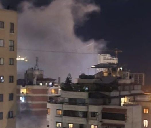
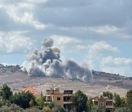
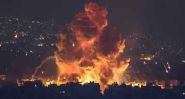
Listen to the article

In a series of four articles, This is Beirut revisits three key elements of the Lebanese-Israeli border dispute and a fourth, which is now forgotten. The first focuses on the Ras el Naqoura tunnel, owned by the Lebanese State and registered under land registry number 28/Naqoura. However, following Israel’s occupation, it has been transformed into a tourist area. The second focuses on the north of Ghajar, a Lebanese village occupied by Israel and whose inhabitants are Syrian. The third concerns a forgotten issue. It concerns the seven Lebanese villages that the Mandatory Powers attached to Palestine in 1923.

The matter of the seven Lebanese villages annexed in 1923 by British and French mandate authorities to Palestine frequently resurfaces in popular circles when it comes to the issue of land demarcation between Lebanon and Israel. Can Lebanon claim restitution of these localities?

Yuval, Margaliot, Ramot Naftali, Youftah, Malikah, Yiron, Afikim and Choumra. These are Hebrew names given to Lebanese villages. Among them, six are predominantly Shiite, while one, Hounine (or Margaliot), is home to both Christians and Shiites. These villages are also associated with extensive agricultural lands. Geographically situated within the territory of Greater Lebanon, by virtue of an agreement signed in 1920 between the French and British mandate authorities who partitioned the region into zones of influence in the aftermath of the World War I, these seven villages were annexed to Palestine in 1923, before being torn down by the Israelis between 1923 and 1948.

During the massacres that have been perpetrated in the area during this period, inhabitants either lost their lives or managed to escape. “Those who survived were able to cross the Lebanese border and take refuge in various regions of the country,” explains former commander of the southern Litani River sector in the Lebanese army LAF, General Khalil Gemayel.

Originally spanning 74 km2, these villages were named Ibel Kamh (for Yuval), Hounine (for Margaliot), Nabi Youshah (for Ramot Naftali), Qadas (for Youftah), Malkiyeh (for Malikah), Salha (for Yiron and Afikim) and Tayr Bikha (for Choumra).

“The inhabitants held Lebanese identity cards issued in 1921 by the government of Greater Lebanon (see images) and paid their taxes to Beirut collectors,” noted General Khalil Gemayel, former commander of the southern Litani River sector within the Lebanese army.

The Reasons Behind the Annexation

In the Houla Valley, now situated in northern Israel, a “trade-off” between the British and French mandate authorities triggers a turn of events and brings about changes at both geographical and demographic levels. Lebanon ultimately pays the price for these consequences. Lebanon will bear the brunt of it.

In this valley, after the Balfour Declaration of November 2, 1917, pursuant to which the British planned to establish a Jewish national home in Palestine, Jewish organizations put forward numerous proposals to gain fertile lands, develop their economy and enable Jewish immigration expansion.

One of these proposals entailed the drainage of marshy areas, including that of Houla Valley, abandoned by Arabs due to the rampant spread of malaria there. The marsh dewatering works were assigned to a French company with the aim of converting the area into agricultural land.

However, when it came to delineating the borders between Lebanon (under French mandate) and Palestine (under British mandate) by virtue of the Paulet-Newcombe agreements* of 1923, the Jewish community demanded that the seven Shiite villages be annexed to Palestine. In exchange, they secured the renewal of the concession contract for the French company responsible for marsh dewatering. A deal was struck.

The seven villages were “ripped out” from Lebanon and annexed to the area under British occupation to enable the French to continue their activities in the Houla Valley. While some experts mention a larger number of localities (often cited as 24 villages), General Gemayel stresses that “not all of these were inhabited by Lebanese officially holding Lebanese nationality, hence the focus on the seven mentioned.”

What Fate Befell the Seven Villages?

In May 1948, Hounine village was targeted by an Israeli raid, prompting many residents to flee. While some stayed, women were raped and assassinated by Israeli soldiers. Subsequently, in September 1948, the Israeli forces once more attacked the village with explosives, causing the destruction of all its dwellings.

The destiny of Tayr Bikha village mirrors that of Hounine. It was besieged, plundered, and subsequently occupied by Jewish immigrants brought from Hungary and Romania as part of a broader effort to Judaize the Galilee. As a result, Tayr Bikha was left abandoned by its original inhabitants. While the villagers were forbidden from harvesting their crops, the Jewish settlers were authorized to do it.

The storming of Salha village is a particularly bitter memory for the few inhabitants that survived it. Among the approximately 105 persons recorded as perished, 94 met their demise as Israeli forces detonated the dwellings they occupied. Massacres and atrocities were perpetrated there.

Despite being buried under the rubble, remnants of the village of Nabi Youshah endure. Its inhabitants tried somehow to resist the Israeli forces; however, the village eventually became depopulated.

At Qadas, where all inhabitants were killed by Israeli forces, only a few ruins remain to recall the houses that were destroyed there. Among the remnants, trees, including eucalyptus, fig and mulberry, have taken root. Flat areas where the village once stood now host apple orchards. Meanwhile, the former water source, once used for irrigating the locality, now serves as a watering hole for livestock.

Between May 15 and June 6, 1948, the newly established Lebanese army engaged in three fierce battles against Israeli forces in the village of Malkiyeh. Succeeding in liberating it from Israeli occupation, the Lebanese army turned it over to the Arab Liberation Army (established in 1948, at Syria’s initiative, to defend Palestine). In 1949, the Malikah kibbutz was installed in this village.

At Ibel Kamh, no direct combat was reported, as the inhabitants fled upon receiving warnings of the massive arrival of Jewish reinforcements in Galilee. The village was occupied in May 1948.

Although these seven localities are currently “lost” to Lebanon, they continue to be claimed by certain Lebanese parties. In 2000, both Hezbollah and the Lebanese government called for the return of Shebaa Farms, the village of Ghajar and the seven villages to Lebanon. However, fulfilling this request is impossible to realize as “the borders currently under negotiation are those established in 1949,” says General Gemayel. In this context, it is worth noting that following the establishment of the State of Israel in 1948, an armistice was signed on March 23, 1949, between Lebanon and Israel under the auspices of the United Nations. The armistice line was subsequently drawn, resulting in Lebanon losing 16 square kilometers from the Paulet-Newcombe line.

*On March 7, 1923, in the aftermath of the World War I, the French and British governments forged an agreement to delineate the borders between Lebanon and Syria on one side, and Palestine on the other, thus partitioning these countries, once under Ottoman domination. This agreement, named after French Lieutenant-Colonel N. Paulet and British Lieutenant-Colonel Stuart Newcombe, comprised 71 points: 38 delineating the borders between Lebanon and Palestine and 33 between Syria and Palestine. It marked the first official demarcation between the two countries.

Subscribe to our newsletter

Newsletter signup

Please wait...

Thank you for sign up!