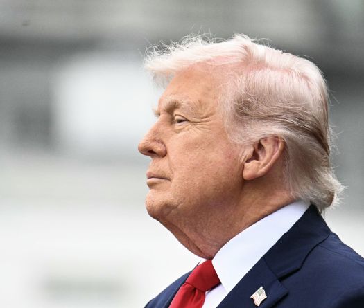
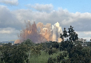
Listen to the article

In a series of four articles, This is Beirut looks at three key elements in the Lebanese-Israeli border dispute, and a fourth that has fallen into oblivion. The first concerns the Ras Naqoura tunnel, owned by the Lebanese state and registered in the land register under number 28/Naqoura, but which Israel turned into a tourist zone since occupying it.

The “package deal” negotiations aimed at resolving the conflict in Gaza and restoring calm in southern Lebanon must address, from the Lebanese perspective, the issue of delineating the land borders between Lebanon and Israel.

This matter resurfaced with the outbreak of the Gaza war on October 7 and has been repeatedly raised by American envoy Amos Hochstein during his multiple visits to Beirut as part of his efforts to resolve the crisis.

According to well-informed sources, discussions on this topic are already underway and will materialize once the war between Israel and Hamas concludes.

Ras Naqoura Tunnel figures among the contentious points to be resolved in this context, part of which is occupied by Israel but claimed by Lebanon.

Ras Naqoura Tunnel, serving as a border point connecting Lebanon to Palestine, is officially recognized as property of the Lebanese state, yet it remains entirely under Israeli occupation. Israel blocked its exit on the Lebanese side by constructing a concrete wall.

The tunnel is among the 13 disputed spots along the Blue Line (the UN-established withdrawal line after Israeli forces left Lebanon in 2000) and the 18 contentious points arising from the Israeli forces’ installation of the technical barrier beyond the Blue Line.

To understand why this zone is highly contested, one must examine the previous border delineations between the two countries. The border between Lebanon and Israel extends from Ras Naqoura to the Wazzani River, while the border with Syria extends from the Wazzani River to Golan Heights, currently occupied by Israeli forces. However, between Lebanon and Israel, there are not just one but three main borders:

The Paulet-Newcombe Line: An Initial Demarcation

On March 7, 1923, following World War I, French and British governments concluded an agreement delineating the borders between Lebanon and Syria on one side and Palestine on the other, dividing these countries, formerly under Ottoman rule. The agreement, named after French Lieutenant Colonel N. Paulet and British Lieutenant Colonel Stuart Newcombe, comprises 71 points: 38 identified between Lebanon and Palestine and 33 between Syria and Palestine.

If we look at the 38 demarcation points, “they begin with point BP1 at Ras Naqoura in the west and end in the east with point BP38 at the Roman bridge on the Wazzani River (BP meaning Border Point),” explained retired Lebanese Army General Khalil Gemayel, who was Sector Commander of the south of the Litani sector, in an interview with This Is Beirut.

Negotiations between N. Paulet and S. Newcombe concluded with an agreement under which “seven villages, considered Lebanese in 1920, were ‘lost’ by our country in favor of Palestine,” he added.

The Armistice Line

Following the establishment of the State of Israel in 1948, an armistice was signed on March 23, 1949, between Lebanon and the Hebrew state under the auspices of the United Nations.

In Article 5, paragraph 1, the agreement specifies that “the armistice line follows the one that separates Lebanon and Palestine, namely the Paulet-Newcombe line,” according to General Gemayel.

Thus, the 38 points of the 1923 agreement are retained, with an additional 105 intermediate points added for greater precision in the delineation. This results in a total of 143 points, starting not from BP1 (used as reference by the Paulet-Newcombe agreement) but from point B1, closer to the sea, at Ras Naqoura.

With the signing of the armistice treaty, “Lebanon lost 16 km² between the Paulet-Newcombe line and the armistice line,” as affirmed by General Gemayel.

The Blue Line

The Blue Line does not constitute a border line; it is rather a withdrawal line, marked by blue barrels, and drawn by the UN in 2000 after the Israeli withdrawal from south Lebanese territory, which Tel Aviv occupied for 22 years. It starts from Ras Naqoura and ends at Wazzani, at the level of the Roman bridge.

Although it is 121 kilometers long, the Blue Line does not satisfy the Lebanese government, which has reservations about its delineation, particularly concerning thirteen points (hence the thirteen contentious points).

In addition to these three main delineations, there is a technical barrier which was installed by Israeli forces in 2007. Although not officially recognized, it serves as a means for Israel to enhance its security. After the construction of the technical barrier, 18 contentious points were added to the previous thirteen (referring to 18 villages occupied by Israelis).

Ras Naqoura Tunnel

In 1942, Ras Naqoura Tunnel, part of the railway line connecting Haifa to Tripoli via Naqoura, was inaugurated by the British. Built primarily to facilitate the transport of military equipment, the tunnel ceased to function during the War of Independence in 1948 when Israeli troops destroyed its installations in order to prevent invasion.

The tunnel is approximately sixty meters long. It is registered in the land registry under number 28/Naqoura and is under Israeli occupation.

In 2000, after the withdrawal of Israeli forces, the Israeli state blocked the tunnel exit on the Lebanese side with concrete, preventing access from Lebanon. Furthermore, it transformed the area into a tourist site visited by thousands annually.

The tunnel itself constitutes a three-fold contested zone as it is part of the 13 contentious points along the Blue Line, the 18 contentious points of the technical barrier, and a significant portion of the tunnel interior (40 meters) is illegally occupied by Israel.

Nevertheless, it seems inconceivable for Tel Aviv to relinquish such a strategic zone, especially considering Israel’s attempt to shift the starting point (point B1) to coincide with its technical barrier to expand its territory.