- 07
- July
- 2025

When Greater Lebanon was proclaimed on September 1, 1920, by General Henri Gouraud, a new geopolitical reality emerged. The newly formed Lebanese State extended beyond historic Mount Lebanon to include parts of the Sanjaks of Tripoli and Saida, the city of Beirut and 4 districts annexed to Lebanese territory: Baalbeck, the Beqaa, Rashaya and Hasbaya.
To define this new entity, it was essential to establish its borders. On August 31, 1920—one day before the proclamation—General Gouraud issued Decree No. 318, outlining the state boundaries based on the annexed districts. These administrative limits, inherited from the Ottoman Empire, came to be regarded as Lebanon’s political borders, explains retired General Khalil Gemayel, former head of the Lebanese Army’s South Litani sector, in an interview with This is Beirut.
For example, in the Hermel district, the border village of Qasr served as a reference point. Similar localities dotted the separation line between Lebanon and Syria, reflecting boundaries that dated back to Ottoman rule.
Unlike the southern border with Palestine—which was under British mandate and marked by a clear military line—the Lebanese-Syrian border was never precisely demarcated, since both territories were under French mandate. Consequently, it became an administrative or civil boundary, defined by local realities on a village-by-village basis.
Brigadier General Jihad Merhi, specialist in History and Geopolitics, emphasizes, “A definition is not a demarcation.” For a border to be officially recognized, 5 steps must be completed: definition, demarcation, marking on the ground, bilateral and international agreement and finally, administrative and security management.
“While General Gouraud completed the initial step, the others were left unfinished,” notes Merhi. During the French Mandate, the Lebanese-Syrian border was viewed as an internal line within a single territory under Paris’ control, explaining the French authorities’ lack of interest in formally demarcating it. French archives refer to these boundaries as “internal administrative borders.”
Early Attempts at Border Delimitation
Starting in 1923, the Representative Council of Greater Lebanon commissioned French and Lebanese topographic engineers to delimit the border. One of the most notable figures was Camille Deraffourd, head of the topographic section of the Land Services under the French High Commission in Syria and Lebanon. He was tasked with defining Lebanon’s border with Syria, recounts Gemayel. His painstaking work, complicated by numerous local disputes, covered a large stretch from Nahr al-Kabir in the north to Ras Baalbeck. The project halted in 1939 with the outbreak of World War II, and Deraffourd died in Lebanon in 1941.
In the 1930s, French Captain Dujardin was also appointed to assist. “While Deraffourd’s surveys were accepted by Syrian authorities, parts of Dujardin’s findings were contested—particularly in the area between Ras Baalbeck and the border village of Nahleh, now one of the most disputed zones, spanning roughly 130 square kilometers,” notes Gemayel.
The border question, unresolved after 1939, resurfaced following the French withdrawal and the end of their mandate.
When Cadastral Boundaries Aren’t Enough
After Lebanon and Syria gained independence in the 1940s, efforts to delimit the border resumed. “Joint Lebanese-Syrian commissions were formed to continue the work,” says Gemayel. One of the most effective was a committee led by Syrian judge Ahmad Abara and Lebanese officer Antoine Dahdah, director of geographical affairs in the Lebanese Army. While many disputes were resolved, several points of friction remained—a challenge explored further below.
Regarding methods, Merhi explains that some boundaries were drawn based on cadastral records of private properties, identifying the last parcel registered to a Lebanese owner and the first to a Syrian. This cadastral approach helped partially resolve certain disputes.
State-owned lands with no private ownership or clear cadastral records were more difficult. Here, land markers were absent, and villages often overlapped, with Syrian residents living on Lebanese territory, sometimes for generations. A notable example is Mazraat Deir al-Ashayer (Rashaya), officially Lebanese land but largely inhabited by Syrians who depend on Damascus for public services.
“These complex situations require political solutions first and foremost,” stresses Merhi. Technically, options include long-term leases, land swaps or administrative transfers to regularize ownership. But after a century of de facto occupation, any resolution must address both territorial and social realities.
Understanding the Conflict
The nature of the dispute is complex and varies by area, outlines Gemayel. First, some borders are clearly defined and uncontested, such as the stretch from Arida to Wadi Khaled in northern Lebanon. Second, some borders are recognized by both countries but include one or more disputed zones—there are 12 such cases. For example, in Akkar, while borders are accepted, the village of Wadi Khaled (Lebanon) is contested with Beznaya (Syria), as is Akroum (Lebanon) with Akkoum (Syria).
Third, some borders have disagreements not limited to specific areas; about 21 points of friction fall into this category.
Finally, two villages have disputed sovereignty: Mazraat Deir al-Ashayer (Rashaya) and Nkheileh (Hasbaya), the latter now completely destroyed but claimed even before the Israeli occupation. In Mazraat Deir al-Ashayer, within Lebanese territory, roughly 60% of residents are Syrian and 40% Lebanese.
Which Areas Are Disputed?
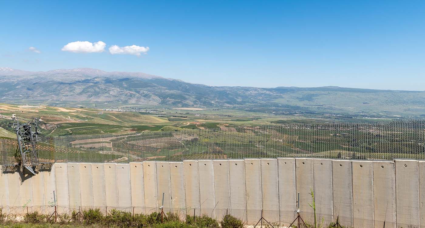
Today, 35 points of dispute remain along the 375-kilometer Lebanon-Syria border, with the remaining 50 kilometers in the Golan Heights under Israeli control, according to Gemayel. These contested areas cover about 200 square kilometers and are distributed as follows: Akkar has two disputed points along 100 kilometers; Hermel has 4 over 25 kilometers; Baalbeck accounts for 20 disputes across 155 kilometers; Zahleh has 4 over 30 kilometers; Rashaya has 4 over 65 kilometers; and Hasbaya has one over 50 kilometers.
The most complex dispute remains the area studied by Colonel Dujardin, between Ras Baalbeck and Nahleh. Beyond figures and maps, realities on the ground present additional challenges. While some disputes can be precisely identified and theoretically resolved through negotiation or land adjustments, the border’s mountainous, intertwined and historically neglected nature makes it a porous and difficult-to-control frontier.
The Lebanese-Syrian Border: The Country’s Security Achilles’ Heel
The rugged mountainous terrain makes systematic military control nearly impossible, explains Merhi. Along the 375-kilometer border, numerous illegal crossing points exist between hills and valleys, often unmarked and unofficial but well known to local networks. Smuggling is rampant, involving fuel, food supplies and medicines, as well as arms and drugs. However, most of the trade involves economic goods that have become vital livelihoods for entire families. For example, in 2008, networks smuggled Sudanese workers across the border for domestic and agricultural jobs in Lebanon, reveals Merhi.
Today, approximately 4,000 to 6,000 Lebanese soldiers are deployed along the eastern border, divided into 4 regiments extending to Rashaya. Each regiment has roughly 1,000 to 1,500 troops, often concentrated in secure centers for mutual protection. Yet, this presence remains insufficient to effectively control such difficult terrain. Merhi notes Lebanon has around 15 observation towers but cannot realistically station a soldier every five meters. Consequently, national sovereignty in this region remains largely theoretical.
A Strategic Challenge for the Lebanese Army and State
“Fixing the borders is more than a technical task; it is a fundamental assertion of sovereignty,” stresses the brigadier general. Today, the Lebanese Army is stretched thin across multiple internal fronts, limiting its ability to focus on its primary mission: securing the borders. “If internal conflicts were resolved and internal security responsibilities delegated to other state bodies, the army could strengthen its presence along the eastern frontier,” he insists. Achieving this requires a shared political will. Coordination between Lebanon and Syria is therefore essential, particularly as border demarcation has been stalled since the 1970s.
Whether the current situation in Syria, marked by regime change and profound instability, will lead to renewed border talks remains uncertain.
It is also unclear if documents and maps from the French archives on Lebanon-Syria border delimitation, handed over last May by French Ambassador Hervé Magro to Lebanese Foreign Minister Youssef Rajji, will help break the deadlock.
Finally, the prospects of the US roadmap, presented by US envoy Thomas Barrack to Lebanese authorities on June 19, being seriously considered remain to be seen—especially its calls for restoring ties with Syria and advancing border demarcation between the two countries.


Comments